
Just by looking at the ferry terminal to Governors Island, you know that you're visiting an island that is historic & beautiful.


It is situated at the lower tip of Manhattan, at the end of Whitehall Street. Using the "red line" 1 Train from Lewis' apartment on the Upper West Side, we arrived at the South Ferry subway station. (Despite a mere distance of 9 miles, the trip consumed 33 minutes because of the outdated subway).

Whitehall Street is one of the city's oldest: created by Dutch settlers in 1626. After the British conquered the city, it was renamed in 1731 for England's center of government, which was built on the site of the former Royal Palace of Whitehall (built in 1530 and larger than Versailles until it burned in 1698).


(The Florentine explorer, Giovanni da Verrazzano--whom a bridge is named after--saw the area in 1524 on behalf of King Francis of France. But it was Henry Hudson--sailing from Amsterdam in 1609--who encouraged Prince Maurice of Orange to create the first Dutch settlement).
The ferry terminal sits beside the less-attractive Staten Island ferry terminal.

The ferry terminals are where the original Dutch canal reached the bay: Gentlemen's Canal, named after the grander one in Amsterdam. In the photo above, you see that the terminals face a small redbrick building, preserved amidst soaring skyscrapers. That is Federal Hall, where George Washington was sworn in as the first President of the USA.
Lewis and I were excited to explore the newest half of Governors Island. Alas, we were less enthused to stand in the waiting room at the terminal because it hasn't been updated since the 1960s.

Like many things related to NYC's government, it hasn't been upgraded and seems like it belongs to an uncaring Soviet era bureaucracy. Despite being a "waiting room", it lacks adequate seating, and there are no posters, artwork, tables, or greenery.
The boat ride to Governors Island is 7-10 minutes.

The island is a National Monument. There is a lot of history there because it was settled before Manhattan Island was. In 1624, the Dutch West India Company was formed and shipped settlers to Governors Island. They called it Noten Eylant, which means Nut Island. They adopted that name from the Lenape tribes of Native Americans; it described the plentiful chestnut trees on the island. In 1626, the company brokered the purchase of Manhattan Island from Native Americans and renamed it Nieuw Amsterdam. Due to misunderstandings by the natives, the cost was merely worth $1,200 in modern money--making it the most legendary real estate deal ever. (Sadly, Americans did worse to the Lenape).

The Dutch used Governors Island as a "springboard" to colonize Manhattan. When the British took the region in 1664, they renamed the island, since it served "the accommodation of His Majesty's Governors" (plural). That is why there is no apostrophe (as in Governor's). Henceforth, the name remained.
Here's a view of the island.

During our ride across the harbor, we saw the antiquated Staten Island ferries... famous for their orange colors.

They are operated by the hugely-corrupt NYC Department of Transportation, which is blamed for the crumbling highways, perpetual roadwork by overpaid workers that never fixes anything, millions of potholes that dent the hubcaps/rims on cars, cracked sidewalks, rusting bridges, lack of municipal parking, and traffic lights that aren't sequenced to aid rush-hour congestion. The ferries are from 1963 and 1981 and haven't been upgraded or replaced. Lewis and I visited several foreign cities, and they all have modern ferries (all-electric), yet America's richest city remains in squalor. Those rusty ferries are not fuel-efficient, nor are they good for the environment.

At least our ferry was slightly newer.

It put visitors ashore at these welcoming gates.


Governors Island is a car-free place. You can rent bikes or 4-wheeled surreys to explore its 172 acres.


Seen below, we purchased slow-roasted pulled-pork sandwiches, served on brioche with rustic-cut fries.


Plenty of lawns exist for volleyball, baseball, frisbee, and picnics!


We encountered Fort Jay, circa 1794.


It is shaped similarly to the fort on Liberty Island that morphed into the base of the Statue of Liberty.

Fort Jay was built on a military site from the Revolutionary War that General George Washington intended to thwart British warships from entering the harbor. However, miscalculations rendered the canons ineffective from reaching those ships. So, Washington and the Continental Army made another "famous retreat" from the Battle of Brooklyn, and the British retook the island. The Crown held the entire City of New York throughout the war. The war ended after America's patriots got support from the Kings of France, Prussia, and Spain. Shocking the world, America promptly backstabbed its supportive allies by making Britain its main trading partner (and never repaying its allies). Sadly, that seems similar to its current global policies.
Fort Jay was finished in 1795, yet--characteristically like many things in NYC--it was already neglected and decaying by 1805! Using more tax revenue, it was rebuilt in 1806. During the War of 1812, when Britain trampled America again, it was never used and sat idle.

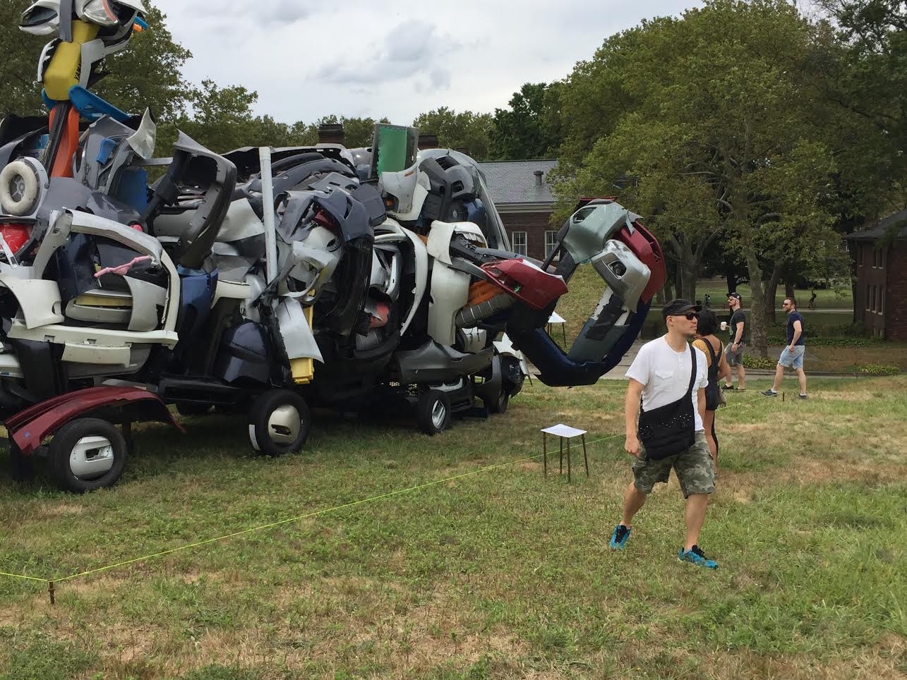
Annual art installations are viewable everywhere. The one pictured below involved wrecked car parts.
Exhibits are displayed inside the old homes on Comfort Road. Built before the Civil War, the houses were for army officers.


Seen above and below, the former Colonels Row contains yellow houses that are now Gift Shops. Typically, visitors can browse Brooklyn-made jams and honey, or hand-knitted trivets, or hipster T-shirts.


We're fond of their front porches (replete with Victorian-era woodwork and ornamental trim), and we like using the white-painted rocking chairs.

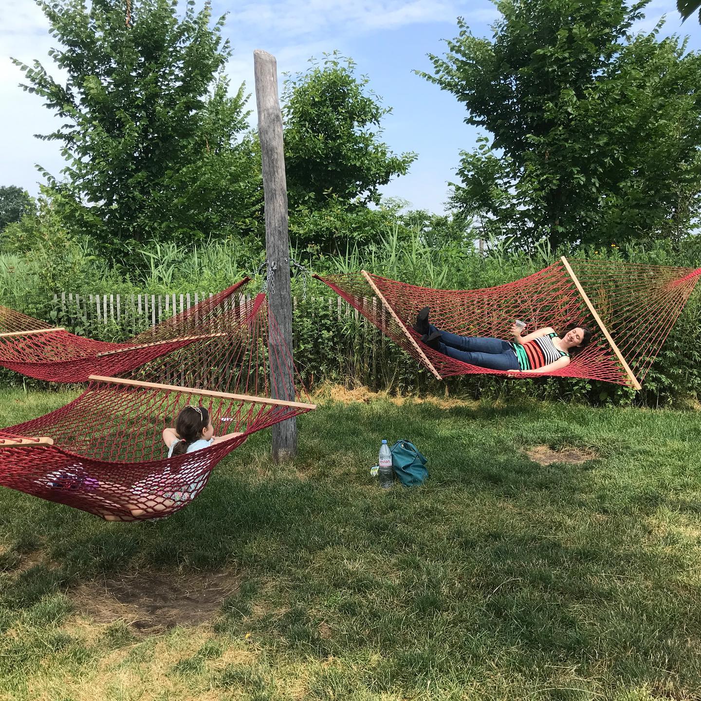
After relaxing on a porch, we went to the newer half of the island and relaxed in the Hammock Groves.


They make their own compost and mulch. They raise chickens.


The farm is solar powered!


Their gardens encircle a cluster of unused, dilapidated barracks. Farmers grow pumpkins, gourds, squash, eggplant, bell peppers, chili peppers, kale, carrots, broccoli, onions, tomatoes (which I tasted), chard, peas, and cucumbers.

A border garden was put to good use to grow herbs.


Looking at the staff-person below, she was indeed a happy farmer, content with her results and $ales.


From there, we passed the baseball and soccer fields...

...to explore the new bike trails, Slides, manmade hills, and a section named Picnic Point.


Two hills have hiking trails that curve & twist upward, giving you great views of the island and the city skyline. The paths are formed with wood chips, and logs are used as steps. Piles of reclaimed stones can be "benches".


It was a fun surprise to come around a bend and see the Statue of Liberty, framed between two hills. The statue is a UNESCO World Heritage Site.


Adirondack chairs are spread all over Picnic Point. They got their name from their origins in the Adirondack Mountains, and they are immensely comfy to use.


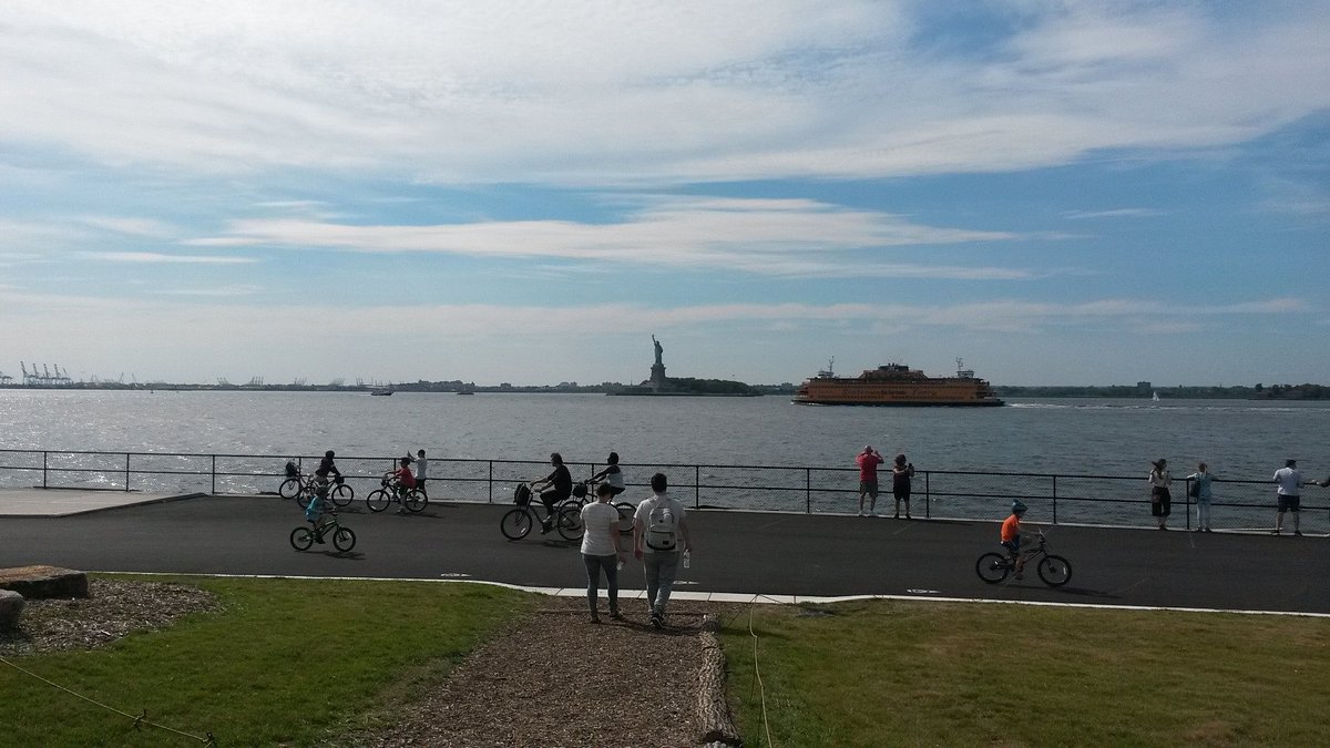
Lewis and I proceeded counterclockwise around the perimeter of the island. Feeling sunshine and breezes on our faces, we enjoyed waterside views of the Atlantic Ocean, the city skyline, Kings County (a.k.a. Brooklyn), and Richmond County (a.k.a. Staten Island). (King's County is named for England's King Charles II, and Richmond County is named for his son, the Duke of Richmond).


That is where they launch kayaking. People can paddle around in an area near the concrete "air vent" for an underwater vehicular tunnel.


Looming ahead of us was Castle Williams, a circular fort built in 1808!


It was initially created as its own island.

Like much of Manhattan, landfill and development joined it to the rest of Governors Island. We entered the fort, but the interior is neglected and unimpressive.


It's a shame that NYC uncaringly doesn't find uses for its historic buildings. Per usual, it will rely on private investors and developers to do the work... some day. Throughout the vastness of NYC, only 7 structures were preserved from the 1700s, and more than half from the 1800s were demolished to build skyscrapers or money-making venues. We hope these old structures can be saved before they deteriorate.

After four hours in our urban oasis, we sauntered to the ferry pier. Ferries depart every 30 minutes. Full of merrymakers, bikers, hikers, foodies, nature lovers, athletes, artists and skateboarders, it was the happiest ferry commute ever!


Several questions/comments:
ReplyDelete1. This looks so neat! I hope to go there when I move home.
2. Do they allow dogs?
3. Where does the ferry depart?
4. Is it open everyday?
5. The garden looks amazing!